
Phi Sua Samut Fort

PLACE: PHI SUA SAMUT FORT (ป้อมผีเสื้อสมุทร)
LOCATION: Pak Khlong Bang Pla Kot sub-district in Phra Samut Chedi District
GPS Coordinates: 13.595494, 100.587549
OPENING HOURS: Daily
ADMISSION: Free
During the late 19th Century, the colonial powers of France and to a lesser extent Great Britain were attempting to carve up parts of Siam for themselves. In order to protect his kingdom, King Rama V ordered the construction of Phra Chulachomklao Fort at the entrance to the Chao Phraya estuary. He also ordered the modernization of other forts on both sides of the river in Samut Prakan so that the approach to Bangkok could be protected. This included the fortress island of Phi Sua Samut opposite the present-day city hall.
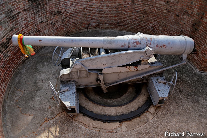
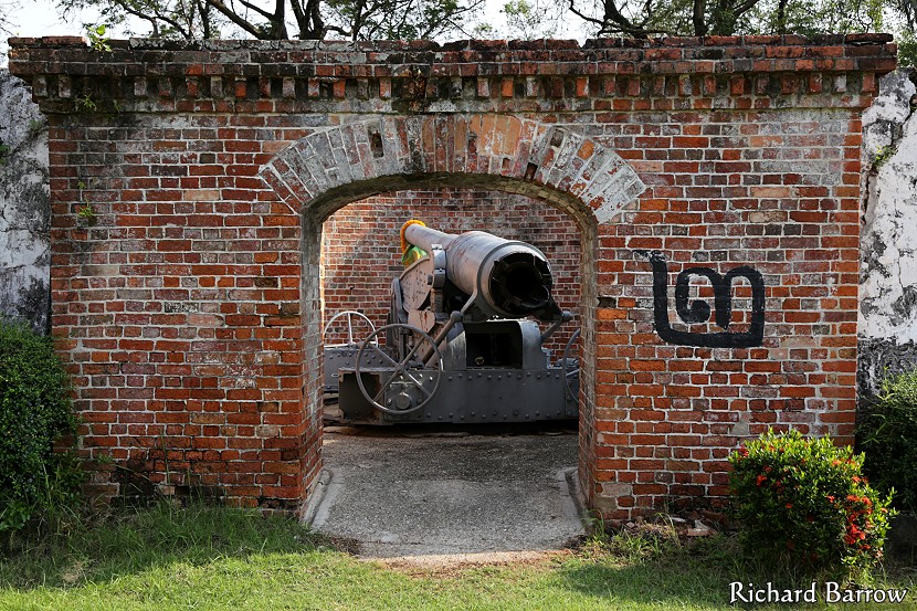
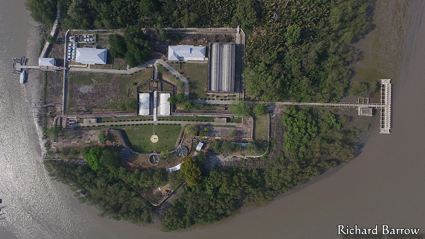
Phi Sua Samut Fort is located on an islet in the Chao Phraya River between two navigation channels in the area of Phra Samut Chedi. King Rama II ordered the building of this fort in 1819. The fort was in the shape of a butterfly (“phi sua” in Thai). The entrance was at the tail. In the past, the armaments mounted at the fort were old style cannons that cannonballs had to be loaded from the muzzle. In 1892, King Rama V ordered ten rear loading guns from W G Armstrong & Co in England. They were called the “disappearing” guns because they only came out of the pit to fire and then the recoil forced the gun back where it came from. This protected the guns from enemy fire.
Seven of these guns were installed at the Phra Chulachomklao Fort. The remaining three were set up at Phi Sua Samut Fort which is an island in the middle of the river. About three months after their completion they saw action for the first and only time. On 13th July 1893, two French gunboats entered the estuary with the intention to blockade Bangkok. Shots were fired and a small boat that was acting as a pilot for the French ships was badly damaged and ran aground. Despite heroic action by the soldiers at the fort and the sailors aboard ships on the river, the two French gunboats managed to slip by. By the time it reached the inner fort it was too dark for anyone to continue the battle. The gunboats were then able to go all the way up the river to Bangkok.
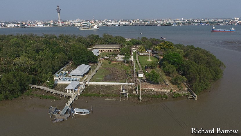
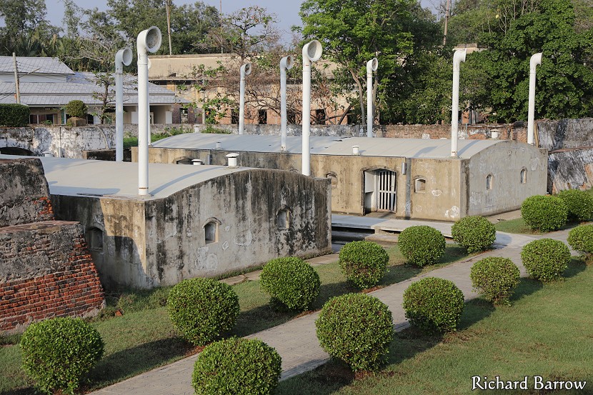
Phi Sua Samut Fort is one of the few battlements left in Samut Prakan that is still in a good condition. This is probably because it is on an island with restricted access to the public. I first visited the island back in 2006 when the Navy were just finishing their renovation of the fort. The idea was to open it up as a tourist attraction. Although you won’t see it promoted in any tourist guidebook, it is possible to visit the island. At the northern end of the island there is now a bridge that connects to the mainland near Phra Samut Chedi. The bridge and island is not officially open yet, but it is still possible to cross and explore the old fort. There is also a nipa palm forest walk where you will be able to thousands of fruit bats. The bats fly out at dusk which is quite an amazing sight if you happen to be there.
Map for Phi Sua Samut Fort:
Other attractions in this area:
[column-group]
[column]
Phra Samut Chedi District:
[/column]
[column]
Pak Khlong Bang Pla Kot sub-district:
[/column]
[/column-group]
Samut Prakan is divided into six districts: Amphoe Mueang, Amphoe Bang Bo, Amphoe Bang Phli, Amphoe Phra Pradaeng, Amphoe Phra Samut Chedi and Amphoe Bang Sao Thong. Click on the links to see tourist attractions from each of those districts.