
Samut Prakan 1935

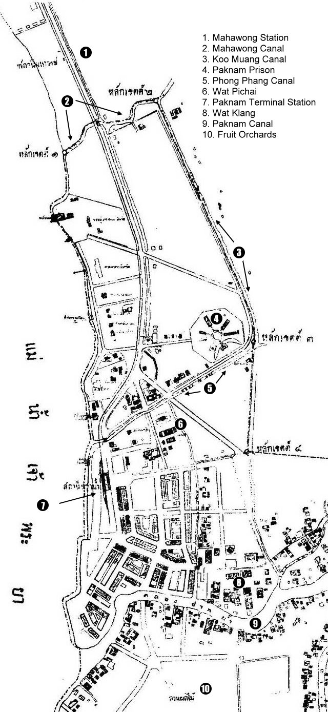
This is a map from the Samut Prakan Archives dated 1935 A.D. The quality is not very clear but I have marked some landmarks. There doesn’t seem to be any sign of Prakhonchai Fort. Nor does there seem to be any bridges across Paknam Canal (9). You should be able to work out the moat that surrounded the city at the time. The Chao Phraya River is to the left. At the top of the map you have Mahawong Canal (2) which leads to Koo Muang Canal (3) which joins with Paknam Canal (9). There is another canal which cuts across between Koo Muang Canal and the river called Phong Phang Canal (5). Two of the railway stations can be seen. Mahawong Station (1) and Paknam Terminal Station (7). The distinctive shape of Paknam Prison (4) can clearly be seen. I have marked two of the temples which are Wat Pichai (6) and Wat Klang (8). The captions for other buildings are not clear.To the south of Paknam Canal are some Fruit Orchards.