
Phrakhonchai Fort in 1904

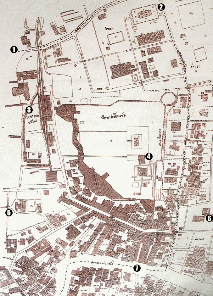
This is a map from the National Archives which shows Paknam City in 1904. In the center of this map you can clearly see the outline of Phrakhonchai Fort. In the middle of the fort is the City Pillar (4). The Chao Phraya River is to the West. The terminus station of Paknam Railway (3) is marked here. Today this area is Paknam Market. This railway ran between 1893-1959. Nothing of the fort remains today. The only evidence is a road named after the fort. Paknam Canal (7) to the south and Phong Phang Canal (1) to the north formed a moat around the fort on three sides. Other features on the map include Wat Pichai (2), the old City Hall (5) and Wat Klang (6).
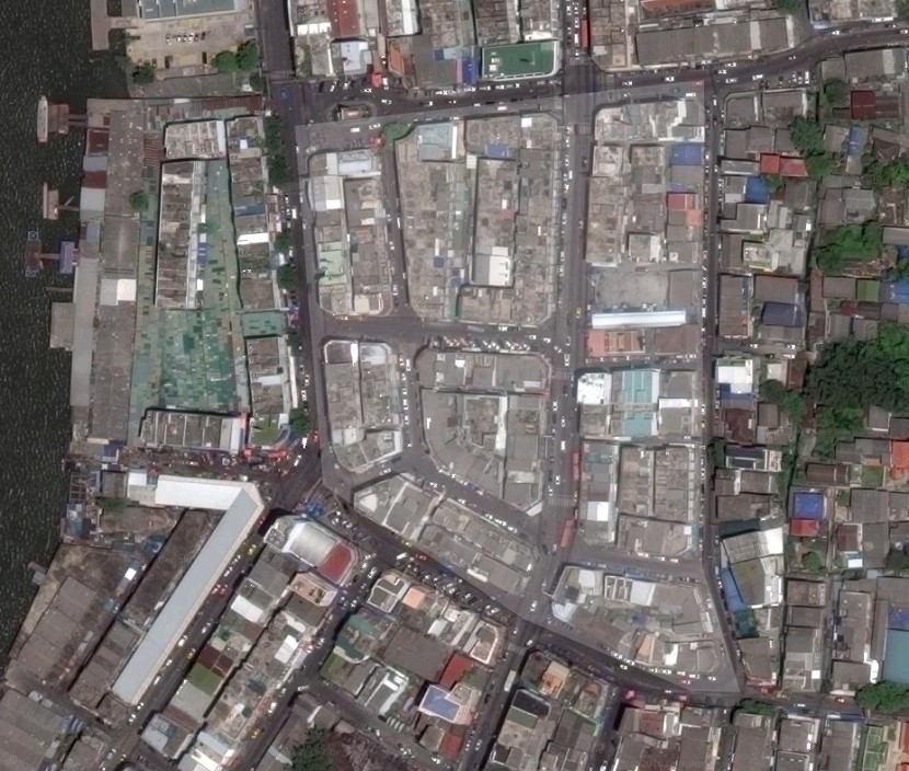
I have marked the area where the fort used to be. You can just see the moat on the right that links Paknam Canal and Phong Phang Canal. The wide road running down the middle from north to south is Prakhonchai road, named after the old fort.