
Ban Sakhla

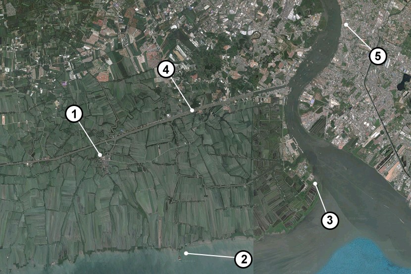
This is a google satellite image for Phra Samut Chedi district in Samut Prakan. The focus here is for Sakhla Village (บ้านสาขลา). As you can see, the majority of the Western side of the Chao Phraya River is a rural area, with many shrimp and fish farms. There are very few roads though some progress has been made on this in recent years. Sakhla now has a bridge over Sapphasamit Canal (4) which means you can now access from two different directions. Also marked are Ban Khun Samut Chin (2), Phra Chulachomklao Fort (3) and Paknam Market (5). You can actually take a boat from Paknam to Sakhla (see my blog here), but it doesn’t go often. Also visit Thailand Photo Map for a day trip that I did with some friends.
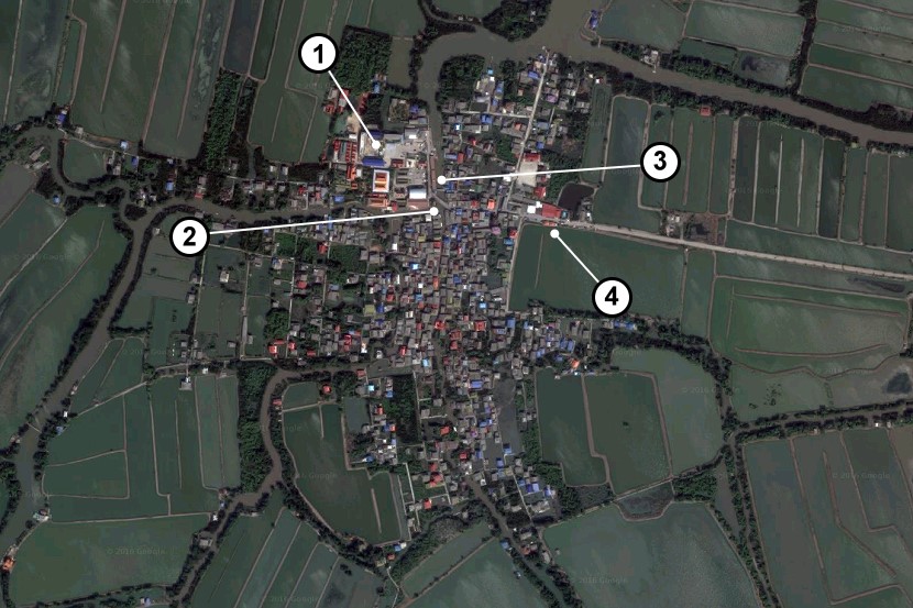
This is a closer image of Ban Sakhla. I have marked Wat Sakhla (1) which is the main attraction in this fishing village. In the southeast corner of the temple complex, there is a small bridge (2) that leads to the riverside market. There is a pier near the temple (3) where you can rent boats to explore the area. They also have a daily boat service to Paknam from here. The songtaew buses to and from Phra Samut Chedi leave from near the 7-Eleven (4). It’s worth exploring this village though you will probably be the only foreigners there.
Here is a direct link to Ban Sakhla on Google Maps if you want to explore this area yourself.