
Samut Prakan 1948

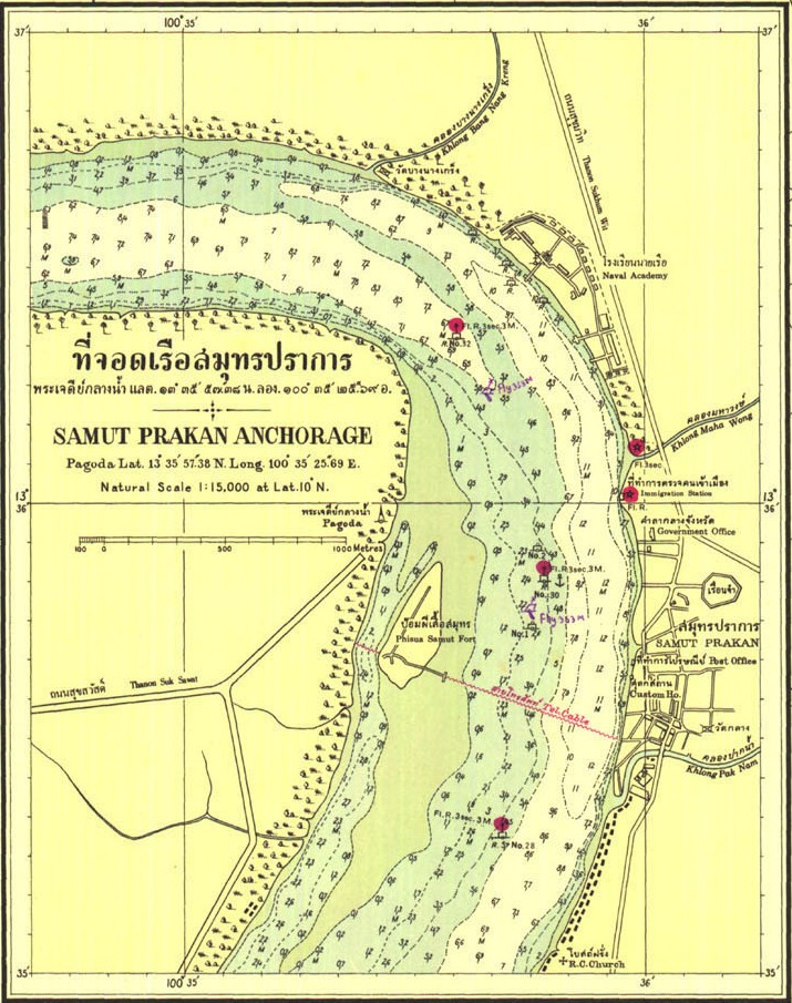
This is a close up of a larger map of the Chao Phraya River from the mouth of the river to King Rama VI bridge in Bangkok. This part of the map shows the Samut Prakan Anchorage. The main map is dated 1929-1930. However, amendments were made to the soundings and the coastline in 1943-1944 and 1948. Presumably this was because the river was dredged during this period to allow the bigger ships access to the port upriver in Bangkok. The dredging caused the river to change direction and also contributed to the Phra Samut Chedi island becoming part of the left river bank. On this map the temple is marked as “pagoda”. Other features marked on this map include the telephone cable that goes from Paknam to the other bank via Phi Sua Samut Fort. The Immigration Office and Government Office seem to be marked in the same place as today. However, the Post Office and Customs House are no longer in the same position. The prison has also been moved to outside the city. Further south you can see the Roman Catholic Church which is still there today.
Click here to download the original map (1.67 MB).