
Samut Prakan 1912

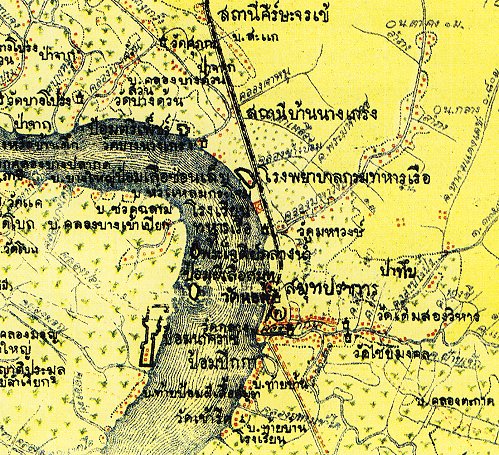
This is a section of a military map of Samut Prakan dated 1912. The black line from the top to the middle is the Paknam Railway line. Just south of the terminus station is marked Pika Fort.The only real section of this that can still be seen today is the air raid shelter that was constructed during the Second World War. On the left bank (opposite Paknam Railway Station) is the outline of Nakarat Fort. There is a school on this site now. I have visited this school and have seen some guns on display in the playground. If you go around to the back of the school, along the river, you will find some evidence of the walls. Up a little and to the right is the small island housing Phi Sua Samut Fort. Just north a little you can just see the outline of another small island called “Phra Chedi Klang Nam”. This is Phra Samut Chedi which is now on the west bank. Up until the early 20th Century, this temple was still on an island. Going further north and following the curve of the river you can see some more forts marked on the map. I have found no evidence of these forts today. A bit further, and off the map, you will reach Phra Pradaeng where you can visitPlaeng Faifah Fort.