
Map of Land Use in Samut Prakan

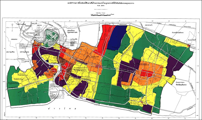
This map shows the land use of Samut Prakan Province. It is colour coded. For example, yellow denotes sparsely populated areas. Red is commercial business areas. Green is industrial areas. Click here for larger version.