Discovering Puchao Saming Phrai Fort

One of the historical legacies of Samut Prakan Province are the Fortresses along the river from the Gulf of Thailand all the way up to Bangkok. At various times through history, going back as far as the Ayutthaya period, there has always been forts here of some description. Many fell into ruins during periods of peace but were built up again by succeeding monarchs. About 800 years ago, Phra Pradaeng used to be the first line of defence as the the coastline was in this area. However, over the years, the land extended further South and Phra Pradaeng lost its importance as a sea harbour. The first temples, in what is now Samut Prakan, were built in about 1350 A.D. Forts soon followed.
In 1768, when King Taksin became the king after the fall of Ayutthaya, he order all of the bricks from the forts at Phra Pradaeng to be moved to Thonburi to build his new palace which practically obliterated the city. However, King Rama I saw the importance of the city as a fortress. In 1809 he commanded for the city to be rebuilt together with Wittayakom Fort alongside Latpho Shortcut Canal. This area is now under Bhumibol Bridge. King Rama II, in about 1815, continued with the building programme at Phra Pradaeng. He had five forts built on the West side of the river and three on the East side. A ninth fort was built about ten years later. At the same time, King Rama II changed the name of the city to Nakhon Khueankhan. He also brought 300 Mon men and their families here to man the forts.
The majority of these forts no longer exist and their exact location has been forgotten. Only Phlaeng Faifah Fort near Phra Pradaeng Municipal Office has been preserved as a city park. Others have been pulled down and built over. For the past few years I have been trying to locate the original position of these long lost forts and then go there to see if I could find any remaining evidence. Then not long ago I came across an old map of the Phra Pradaeng area which marked Puchaosamingphrai Fort on the East bank opposite the municipal hall. It was surrounded by a canal. I used this evidence to cross-check with Google Earth. I found the Southern side of the canal but not the Northern canal. However, on the satellite image, I could just make out something between two buildings that looked like it was ruins of some kind.
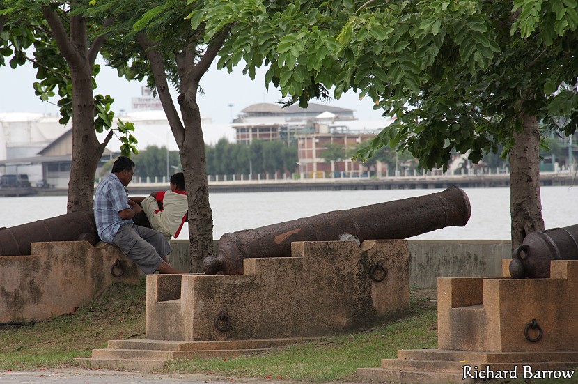
I drove over there at the weekend to check it out. From Sukhumwit Road I turned off onto Puchaosamingphrai Road which leads straight to the Chao Phraya River. This is where we used to have to cross the river by car ferry, but now they have built the two Bhumibol Bridges. Anyway, just before the car ferry I turned left towards Wat Laem and Phrapradaeng Hospital. I parked my car in the car park here alongside the river. Straight away I knew that I was in the right place as there were a dozen big guns lined up along the waterfront. After taking a few pictures here, I turned inland to look for what I thought were ruins on the satellite image. I was looking for a long snake-like building with a red roof. I eventually found it behind the buildings of the Rajapracha Samasai Institute.
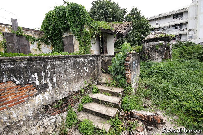
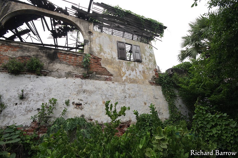
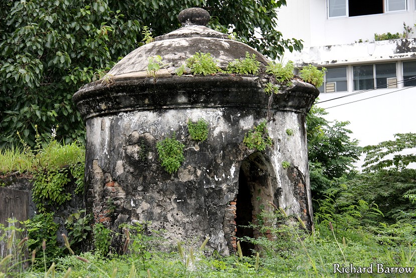
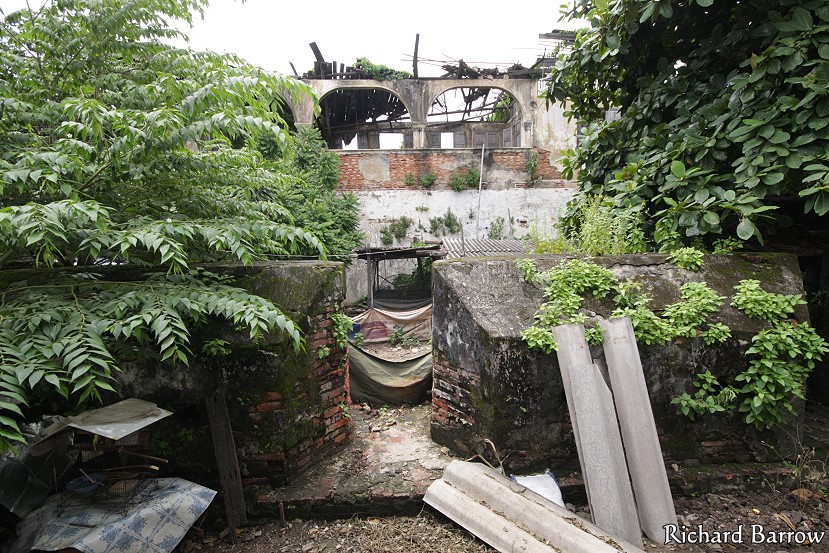
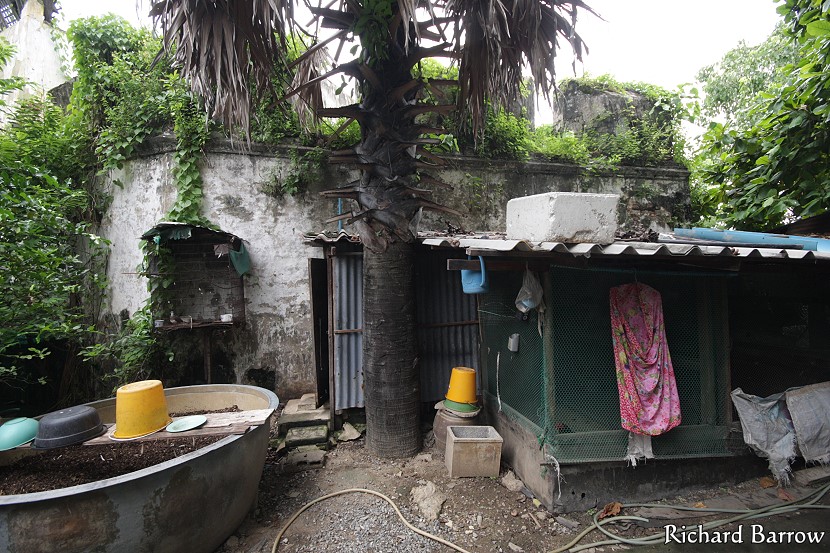
I have been exploring Samut Prakan for many years trying to discover something new or long lost. I know the ruins that I found here at the weekend were in the grounds of a medical institute so it wasn’t exactly a secret. But, it did take my breath away when I first caught sight of the ruins of Puchaosamingphrai Fort. I saw the wall first and then beyond that high up the remains of a wooden building that had collapsed. It looked very much like a lost city as it was now heavily overgrown and squatters had set up shacks around the base. Many of them had physical disabilities and some apparently even had leprosy. For them this was just a place to stay but for me it was an important link to the historical past of the province. It should be preserved for future generations.
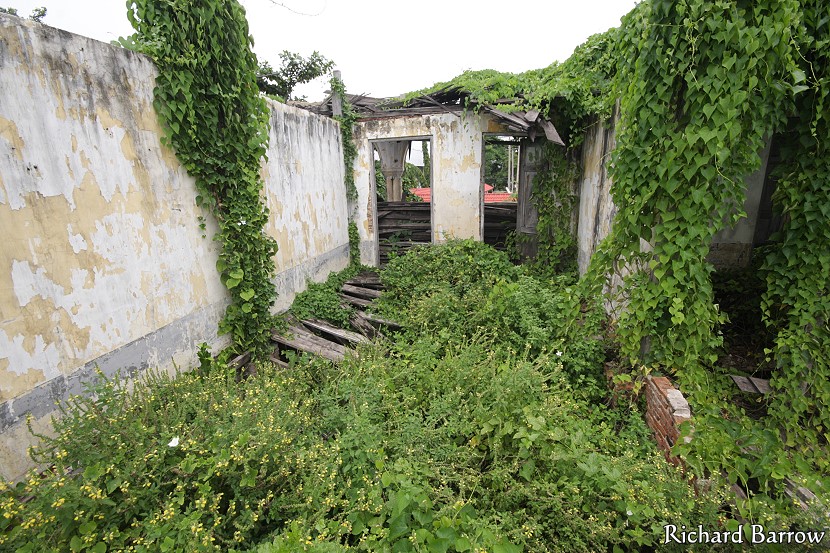
We explored around the ground level first. However, after an encounter with some vicious dogs we went around the back where we found some steps that took us to the top. From what I could tell, an artificial hill had been built and a brick building had been built on top. The wooden roof had collapsed but many of the wooden planks remained which is quite surprising. Many of the shutters on the windows were still there and a couple were banging in the wind. I wondered aloud whether it had been doing that for the last hundred years or ever since it had been abandoned. I looked in through some of the doors but the wooden floors had all collapsed. The place was obviously a death trap and probably home to numerous snakes. But, I was too excited not to pass up on this opportunity to step back in time like this. There are not that many historical ruins left in Samut Prakan.